
Topographic survey: what is it?
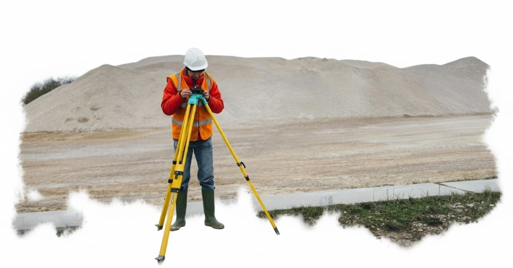 One of the most common types of geodetic work is topographic surveying. Technologies are developing rapidly, and engineers are now able to process tens of thousands of hectares of the earth’s surface in a single shift. Only licensed organisations have the right to carry out topographic surveys and any geodetic work.
When to use a topographic survey
Topographic surveying is the process of determining horizontal coordinates and vertical marks on the earth’s surface. The data obtained is used to produce flat images — topographic plans — and digital 3D models of the site, which are linked to the points of the local or national geodetic network. The plans and models show the relief of the terrain, as well as natural and man-made objects located on it: rivers, lakes, forest plantations, roads, buildings, surface and underground utilities, etc. The relief is shown on the map by means of isolines.
The following types of activities cannot be carried out without topography
- Construction or reconstruction of buildings/structures;
- Laying of roads and other linear objects, engineering communications;
- Development of the territory improvement project (landscape design);
- Preparation of general plans and urban plans of the land plot (GPZU);
- Subdivision of a land plot, allocation of a share, other land surveying works;
- Cartography, updating of topographic and geodetic documentation.
The scale of the survey depends on the purpose for which it is carried out. The most popular is M1:500 (1 cm on the drawing corresponds to 5 m in reality). At this scale, technical communications and other important details are clearly shown on the plan. For the development of a landscape design project, a larger scale is required — M1:200, M1:100 or even M1:50 (1 cm on the plan corresponds to 0.5 m in reality).
A topographic map is made at a scale of M1:10 000 and smaller. It differs from the plan in the distortions caused by the curvature of the earth’s surface and in the way objects are referenced: instead of an orthogonal coordinate system, a grid of degrees is used.
Topographic survey: where to get it
In Kazakhstan, Law No. 332 «On Geodesy and Cartography» is in force. According to it, the right to carry out topographic surveys is granted only to those organisations that have obtained the appropriate licence. Service Geo Company meets these requirements. We use GPS/GLONASS satellite equipment and electronic total stations. UAV aircraft and multicopters are used to survey large areas. Built-up areas are surveyed using tracefinders (to identify underground communications).
Topographic survey: where to get it
In Kazakhstan, Law No. 332 «On Geodesy and Cartography» is in force. According to it, the right to carry out topographic surveys is granted only to those organisations that have obtained the appropriate licence. Service Geo Company meets these requirements. We use GPS/GLONASS satellite equipment and electronic total stations. UAV aircraft and multicopters are used to survey large areas. Built-up areas are surveyed using tracefinders (to identify underground communications).
Topo survey: how to make it
To produce a topo plan you will need to
- Find a surveyor. You can check whether the organisation has a licence to carry out surveying on the website of the Unified State Register of the Republic of Kazakhstan;
- Obtain permission for geodetic surveying of the area of interest from local authorities;
- Draw up a task for the survey, specifying the boundaries of the area, the scale and height of the relief section (height spacing between isolines), the conditions for carrying out the task and other requirements.
- Sign a contract with the surveyors and make an advance payment.
- Topoplan is received and the balance is paid. If necessary, the survey is coordinated with the balance holders of engineering networks.
The company ‘Service Geo’ offers the service in a ‘turnkey’ format. We obtain permissions for surveys and approvals from the owners of utility networks, transfer the drawings to the Cartographic Fund. Our specialists also help the customer to formulate the right task for engineering surveys, which meets his interests, and provide advisory support at the stage of state expertise of the project.
The cost of a topographic survey is calculated individually. The following factors are taken into account
- The size of the site and its type (linear/planar);
- the scale, the height of the relief section and the conditions of the order fulfilment specified by the customer;
- the remoteness of the area to be surveyed
- Complexity of the relief;
- Density of vegetation and buildings.
The most favourable price offers come from those who have their own technical fleet and do not involve third parties. Service Geo is one such company.
What a topographic survey of a property looks like
Examples of topographic plans are shown in the illustrations.
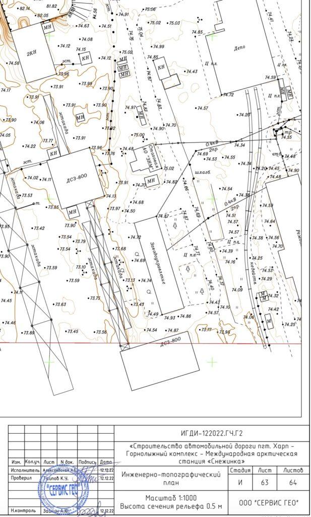
Topographic survey of a site for gasification
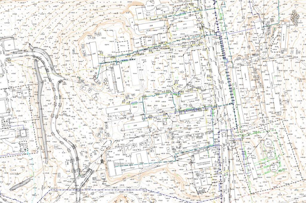 Topographic survey of a built-up area
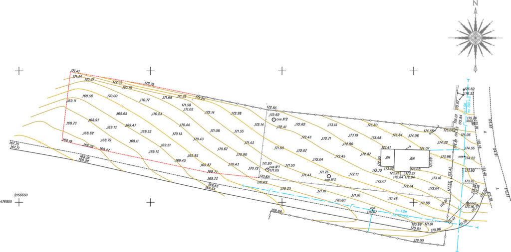
Land survey
How the topographic survey is carried out
The work is carried out in 3 stages:
- Preparatory. Engineers study all available information about the area: materials from previous surveys, archive plans and maps. They then travel to the site and draw up a work plan based on the results of the survey.
- In the field. Having prepared the necessary equipment, engineers go to the site and start toposemovki.
- Chamber. Specialists process the data in the office and prepare a report.
As a result, the client receives:
- Explanatory note with a description of the methods used, indicating the terms of verification of measuring instruments and other information;
- Topographic plan with georeferencing to the state or local geodetic network;
- A digital 3D model of the terrain in the form of a point cloud or a TIN surface (consisting of a set of triangles with a common side in pairs);
- in an appendix — a survey permit from the local authorities, the terms of reference and the work programme.
There are several ways of carrying out field measurements.
Levelling
This technique is used to survey roads, pipelines and other linear objects. It uses a device called a leveller and a geodetic staff. The leveller is used to measure elevations only, i.e. the height above the horizontal plane.
Tacheometric surveying
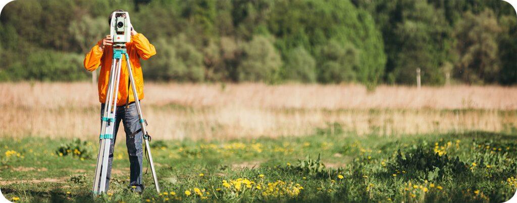 A method for compact areas with a small number of points to be surveyed. A total station, also known as an electronic theodolite, is used. The instrument measures spatial angles and has a built-in rangefinder; calculations are made automatically using a calculation module.
Two people work with a normal total station. In ‘Service Geo’ they use a robotic version of the instrument, which allows them to do without a specialist. This reduces the cost of labour and therefore the cost of the service.
A special device — a trace detector — is used to search for underground communications. The principle of operation is as follows: the pipe is connected to a current generator and then its location is determined by induction. The latter can also be used to locate underground cables.
Satellite (GPS) Surveying
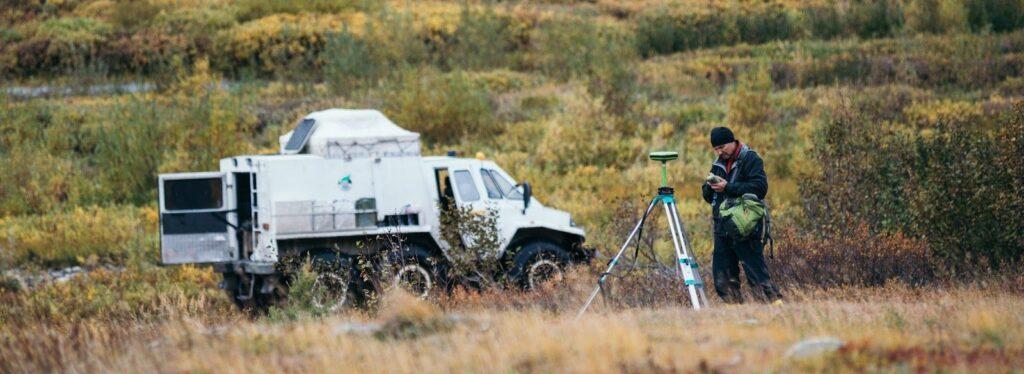 This method uses Global Navigation Satellite System (GNSS) signal receivers. Service Geo works with high precision GNSS systems — GLONASS and GPS. Geodetic class receivers provide an accuracy of up to 1 cm in static mode and 1-3 cm in kinematic mode.
Surveying with GNSS equipment differs favourably from total station surveying in that it is much faster and does not require visual communication with the point of the geodetic network.
Aerial Photography (APS)
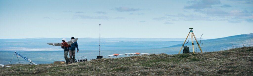 A high throughput method for rapid topographic surveying of large areas. The terrain is photographed by digital cameras with geodetic receivers on board a UAV. The images are analysed by special software using photogrammetry methods (creating a 3-dimensional object from flat images), which then creates a 3D model of the terrain in the form of a cloud of points. The UAV flies up to 800 km per flight and the width of the strip it photographs depends on the altitude (from 100 to 700 metres) and is 150-200 metres.
To create an orthophoto and 3D model, the UAV moves in a ‘snake’ pattern, photographing the area strip by strip. The route is planned so that images from adjacent strips overlap by 60% or more.
The UAV may be equipped with multiple cameras to capture images from different angles. The time of the ASF shall be chosen so that the images are as informative as possible. The presence of leaves on trees, snow cover, etc. should be taken into account. It is best to photograph at 12 o’clock on a cloudless summer’s day, when the illumination of the area is most intense and the shadows are shortest. Acceptable conditions are cloud cover of no more than 20% and a sun elevation of no less than 20° above the horizon.
Prior to the survey, a geodetic reference network is established on the site, linked to the points of the national or local geodetic network. A calibration site should be established to set up the equipment.
Laser scanning
 A modern method of performing topographic-geodetic works. The main elements of the scanner are a laser rangefinder and a spatial angle meter. Knowing the distance to a point and the angle of pulse emission, the computer module easily determines its coordinates. The scanner scans the area, emitting more than 1 million beams in 1 second. The result is a 3D model of the terrain in the form of a cloud of points.
Advantages of laser scanning compared to AFS
- The model is more detailed and accurate;
- The survey is not obstructed by tree canopies;
- the illumination of the site does not matter, you can work in rainy, foggy weather and even at night.
The device is capable of surveying the ground surface under trees with a relief section height of 0.2 metres.
There are several types of laser scanning:
- Airborne. The device is mounted on a UAV or light aircraft.
- Stationary ground. The scanner is fixed to the ground.
- Mobile. A type of terrestrial scanning. The unit is mounted on a rail or road platform. In this way, the area adjacent to the linear object is surveyed.
As with AFS, geodetic network points are set up on the surveyed area before the laser scanner is used. A calibration polygon is also required to set up the equipment.
Topographic survey: what is it for?
A topographic survey is needed to solve a number of tasks. The most common are
- Topographic survey for gasification. In order to issue a TU for the connection of a house, the gas distribution network operator needs to know the situation on site. For this purpose, the applicant is asked to submit a topographical plan.
- Topographic survey for landscaping. A large-scale topographical plan of the site is one of the input data for the landscape design. Designers are asked to show not only relief, trees and buildings, but also large stones, shrubs, stumps and other clearly visible objects.
- Topography for design. The development of a building project is impossible without a topographical plan. With its help, engineers choose the best place for the building, plan slopes for drainage, calculate the volume of earthworks.
- Toposemovka for a building permit. To obtain a document from the Department of Architecture and Construction, you need to submit a package of documents, including a topographical plan of the plot.
- Surveys to calculate the volume. Measurements of excavations on the site to determine the capacity.
- Executive topographical survey. Performed after the laying of utilities or the completion of construction and installation works. Construction supervision is a separate branch of geodesy.
- Surveying measurements at landfills of solid domestic waste (MSW and MSW). Control of mining operations, regular measurements at landfills — a mandatory procedure necessary to determine the volume of stockpiled products. In this case, the method of aerial surveying provides maximum accuracy and short time of measurement.
Service Geo carries out geodesy on the whole territory of Kazakhstan. Conducted objects in all regions:
- Toposemovka Almaty;
- Toposemovka of Astana;
- Toposemovka Almaty map;
- Toposemovka Aktobe;
- Toposemovka Atyrau;
- price survey Almaty.
To apply, order a callback on the site.